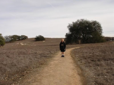
 Today, Brody and I Headed over to the Santa Rosa Plateau to do some exploring. The Visitor Center is a 15 mile drive from home. I never knew there was such a wonderful place so nearby.
We parked in the rock parking lot and entered the Visitor Center. We grabbed a map and a trail guide and paid our day use fees. ($2 for adults and $1 for kids.) We looked at a few of the displays, including replicas of all the native wildlife's poop. (This would come in handy later.) The lady working the counter suggested the Granite Loop Trail as a great place for first timers. Here is your printable Santa Rosa Plateau Trail Map. Click the map to open the trail map PDF.
There are several trailheads on the outside edges of the parking lot. The Granite Loop trail is neat because there are signs with numbers along the way that refer to a section in the trail guide. At each of the 15 signs, we would stop and read about that area. The trail itself is a very nice walk begining through chaparel with large granite outcrops and continuing through wooded areas and some grasslands. We took some pictures along the way.
Halfway through the granite loop, we headed down another trail called Vista Grande. This trail led us into wide open grasslands and far enough away from the main road to really enjoy the sounds and silence of nature. We crossed dry creekbeds, stopped under 300 year old Engleman Oaks and gazed out over the rolling grasslands of the plateau. On one part of a shaded trail near a creekbed, we were able to identify evidence of a mountain lion in the form of poop. (Thanks to the plastic poop in the visitor center) We also found some footprints of mountain lions and coyote in a mud puddle on one part of the trail.
 We stopped for a snack and headed off down Waterline road. This road gets its name from the huge water pipe buried nearby that carries drinking water into Murrieta. As we were walking, a lone coyote crossed the road a few hundred yards in front of us. He is a little hard to see, but look closely in my pictures and you'll find him.
Waterline road took us back to Granite Loop and we headed back via the rest of the loop. We passed Tenaja Truck Trailalong the way, which leads to some old adobe Indian dwellings. We will have to save that 2.6 mile journey for next time.
It would have been fun to take along my GPSr, but I don't have it yet. (I actually got notification that it had shipped while I was typing this blog entry.) There does not appear to be any geocaches on the plateau probably due to the fact that it is an ecological preserve.
The best part of the whole thing was spending time with Brody. We walked and talked and learned and just enjoyed each other's company. While we walked, I couldn't help but think back on my own childhood and all the outdoor exploring I did growing up. These are the things he will remember and hopefully look back fondly on.
We only scratched the surface of this ecological gem and I am looking forward to spending lots of time hiking all the different trails of the plateau. There are vernal pools, great views and plenty of family bonding waiting for us there.


No comments:
Post a Comment