 I was excited for my 200 geocaching finds milestone. The virtual cache at the summit of Mount San Jacinto was going to be the perfect opportunity for a memorable experience. This trip did not disappoint!
The In-Laws are in town and The Kids stayed with them. The Wife and I left the house around 6:45 AM and made the one hour drive to the Palm Springs Ariel Tramway. There was no one in line and we were quickly at the loading area for the next tram. We made up two of the three total passengers on our way up to the 8,516 foot elevation of the upper tram station.
We only had 2318 feet to go to make it to the 10,834 foot summit of this second highest peak in Southern California. No problem, right? We hiked over to the nearby Long Valley Ranger Station and picked up a free yet required wilderness permit. I took this time to unzip the legs off of my pants and remove my long sleeve fleece shirt. The temperature was around 55 degrees and I warmed up quickly on the trail.
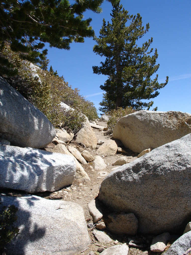
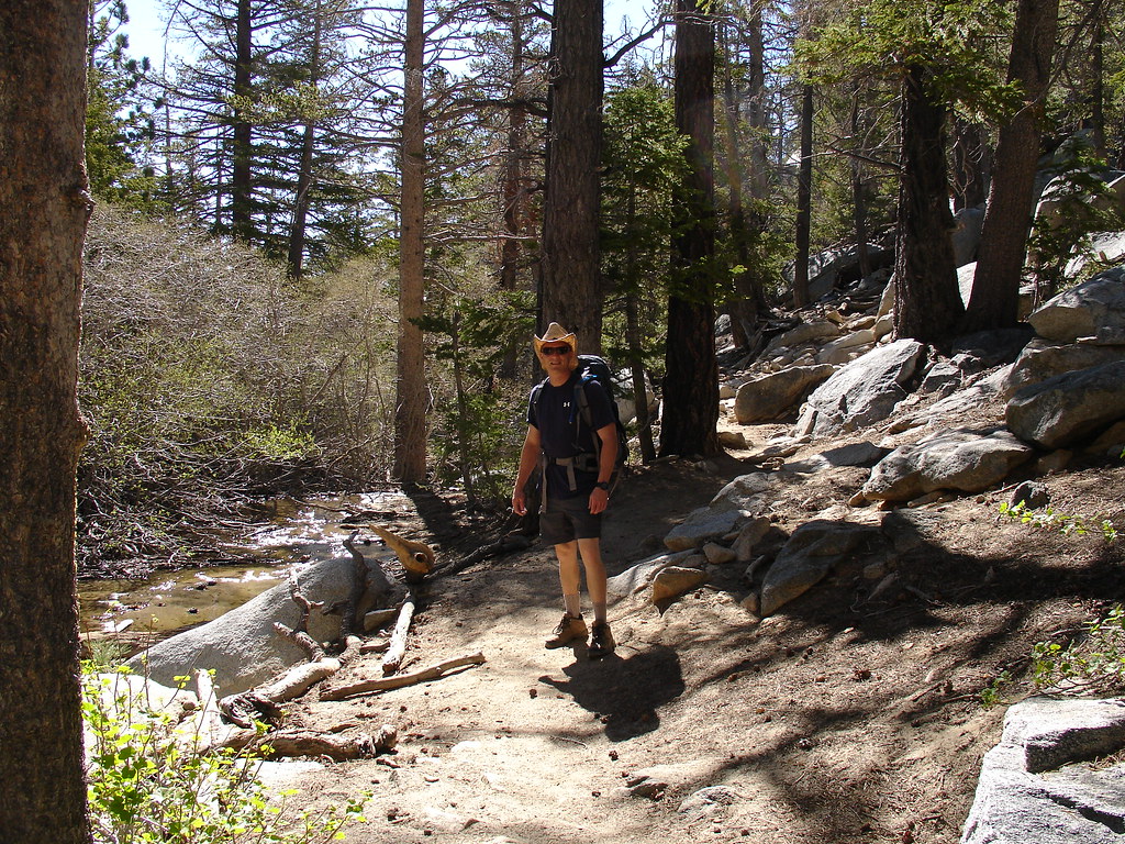
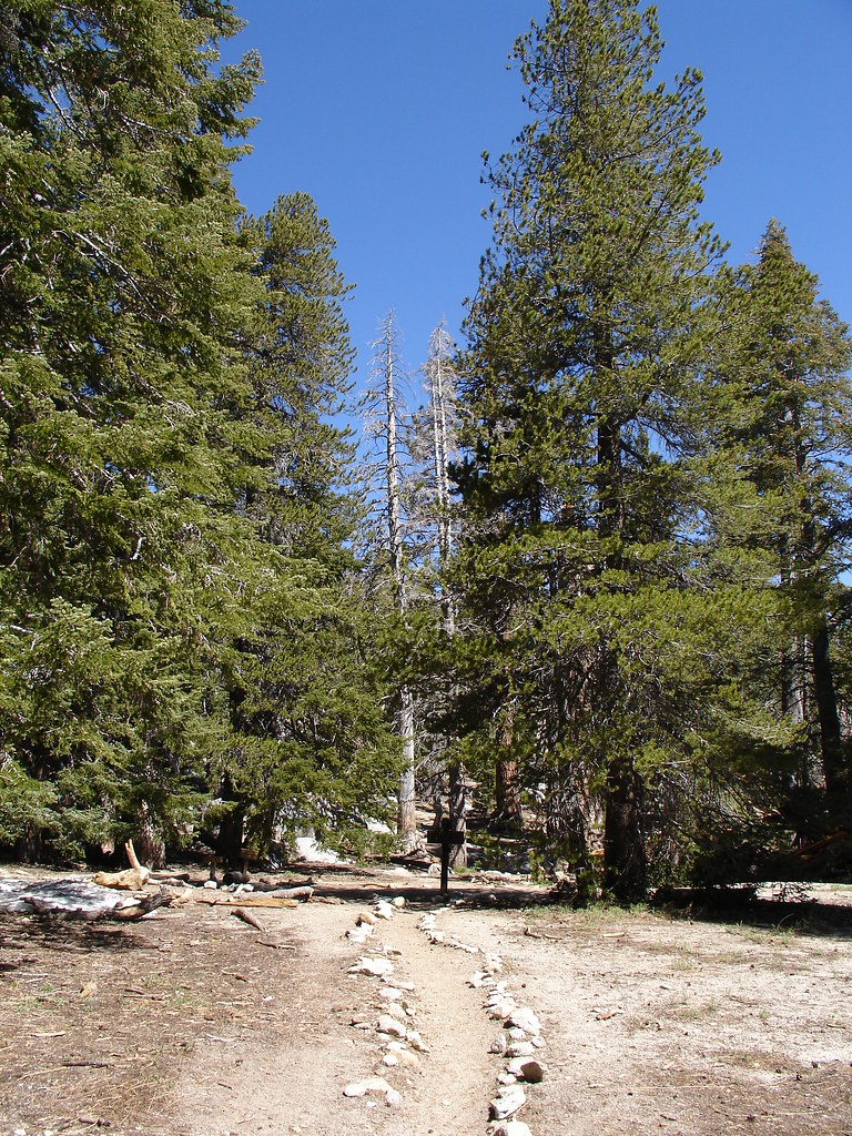
We followed the Southwest trail towards Round Valley. The trail was somewhat rustic and had lots of boulders and fallen trees to negotiate. We were in a beautiful forest of Jeffery Pine and huge White Fir. We followed the Round valley stream up towards the Western end of Round Valley.
We continued past a seasonal ranger station and a couple of campgrounds. We saw a beautiful meadow that just seemed out of place over 9000 feet in the mountains. The last chance for drinking water was a piped spring near the camping areas that said to filter the water before drinking. I'll stick with the 2 liters of water I brought in my Camelbak. We had been in the forest for the first couple of hours and soon came to our first mountain viewpoint. Spectacular! There was a large granite outcrop that provided a nice place to sit and look out as far west as the haze would allow. We sat for a few minutes and had a snack while taking in this teaser of what was yet to come.
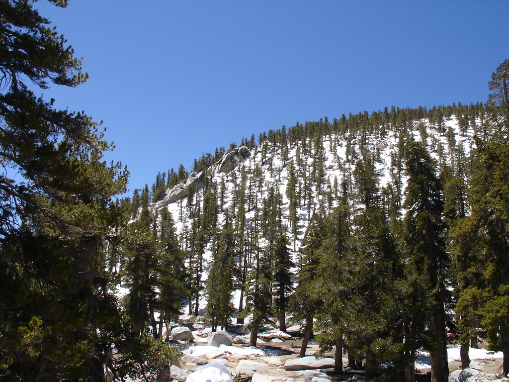
As we kept climbing, we started seeing more snow left over from the winter. There were thick snow banks hiding from the sun in the shade of the trees. We began to see the summit. It was WAY up there still. The forest opened up into thick fields of chinquapin dotted with large boulders and the occasional lodgepole pine. We started up the steep switch backs leading to the summit.
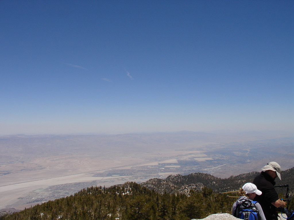
The snow became more frequent and we actually lost the trail for a while. It wasn't hard to figure out where to go. Up. After a few wrong choices we were soon climbing over the huge boulders that make up the summit of Mount San Jacinto. I could finally see the sign marking the feat and found other hikers taking in the views and taking off their boots.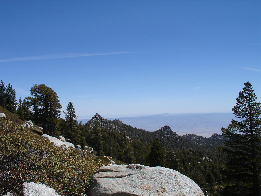 A group of hikers decided that right behind the summit sign would be a great place to relax so it was tough to get pictures without them in the background. We soaked in the views and ate lunch. That PB&J tasted great up there. It was amazing to look to the West and see the green of all the vegetation and then look East and see the desert created by the very mountain we were sitting on. The Eastern slopes are a straight drop 9000 feet down to the valley floor. It was kind of odd standing there.
I had a whole bag of travel bugs that made the journey with us. I took a picture of each one on the sign at the summit. It took a long time to upload each picture to every bug's page and I hope the owners enjoy it.
Soon we were on our way back down. We found where we had missed a switch back and lost the trail. I soon realized that down is tough. My legs were tired. those steps down the trail and off of rocks hurt every time. We didn't take the time to search for any geocaches up there because we need our hotel room to save us.
The trail down seemed to take forever. It seemed so much more steep going down and we wondered how we ever made it up in the first place. The whole way back we kept talking about how great it was and about how badly our feet hurt. The mileage on the GPSr counts off very slowly when you are traveling along switch backs. We retraced our steps and finally made it back to the tram's Mountain Station.
The Tram ride down was full of people and I was imagining my feet soaking in the hot tub. We grabbed some take out and limped up to our hotel room. Second floor, go figure. We did a lot of sitting that night. When I zipped off my pant legs I forgot to put sunscreen on my legs and got a nice little sunburn on the backs of my legs.
We had done it. We made it to the top. The hike was no joke. 11 miles of steep rugged terrain. I was over packed and my knees were letting me know. The views were the best Southern California has to offer. We could see all of the other mountain ranges of SoCal as well as spectacular coastal and desert views. We hadn't even reached the tram and The Wife was planning our ascent to the highest peak in Southern California, San Gorgonio. I think the best investment I made for this trip was a pairs of Thorlos socks. They kept my feet dry and I'm sure I would have had some blisters without them.
The next day was going to reach 100 degrees in Palm Springs and our legs were not ready for the desert hikes and geocaching I had planned. We went for a walk near our hotel and picked up 6 finds along a nice bike path. That 4 mile walk was all we could handle and we surrendered to relaxing and activities that include sitting. While we were walking along a golf course back to our hotel we were watching two large coyotes looking for food in the wash. One of them was on the fairway for a bit. A woman was walking three small dogs in front of us and when one of them barked, the coyotes quickly approached. The woman was unaware of the danger her pooches were in. I got to where the coyote was stalking the dogs along the path and yelled at it. The coyote retreated and I warned the woman that her dogs were being watched.
This has been my favorite trip in the outdoors so far. While I did log the San Jacinto Summit virtual cache, the summit benchmark and an earthcache, the remaining traditional caches on the mountain will have to wait for another day.
I took way too many photos to post here so check out the rest at my Flickr page.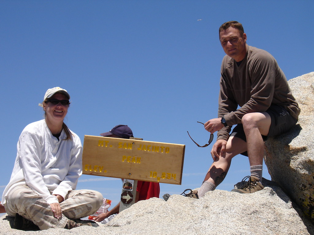

Tuesday, June 3, 2008
Mount San Jacinto Summit Trip
Subscribe to:
Post Comments (Atom)
Have an Idea? Open your free online storefont here.


5 comments:
Congratulations on the milestone and the hike to the summit. My hike would probably be longer, because I think I would freak on the tram.
Kudos on the picture taking of all the bugs up there as well.
Gorgeous! What an excellent milestone!
Congrats on reaching your 2 century mark! You beat me to it. Sounds and looks like it was a great hike.
I visited the Thorlos sock site and ordered me a pair or 2. Thanks for pointing me to another possible way to avoid some foot abuse!
- bren1273
Awesome, awesome, awesome! Sounds like one heck of a fun day and a memorable 200th!
HooHaa Blog
Wow, that sounds really cool. Pictures look great and what an adventure! I thnk that is awesome you took pictures of the TBs on there and posted them, too. Sometimes that is a time consuming process and I hope all TB owners appreciate the effort. Congrats on 200!
Post a Comment