The In-Laws are in town and The Kids stayed with them. The Wife and I left the house around 6:45 AM and made the one hour drive to the Palm Springs Ariel Tramway. There was no one in line and we were quickly at the loading area for the next tram. We made up two of the three total passengers on our way up to the 8,516 foot elevation of the upper tram station.
We only had 2318 feet to go to make it to the 10,834 foot summit of this second highest peak in Southern California. No problem, right? We hiked over to the nearby Long Valley Ranger Station and picked up a free yet required wilderness permit. I took this time to unzip the legs off of my pants and remove my long sleeve fleece shirt. The temperature was around 55 degrees and I warmed up quickly on the trail.
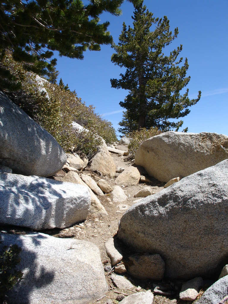
We followed the Southwest trail towards Round Valley. The trail was somewhat rustic and had lots of boulders and fallen trees to negotiate. We were in a beautiful forest of Jeffery Pine and huge White Fir. We followed the Round valley stream up towards the Western end of Round Valley.
We continued past a seasonal ranger station and a couple of campgrounds. We saw a beautiful meadow that just seemed out of place over 9000 feet in the mountains. The last chance for drinking water was a piped spring near the camping areas that said to filter the water before drinking. I'll stick with the 2 liters of water I brought in my Camelbak.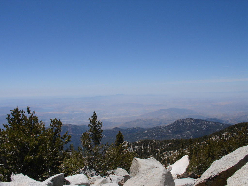
As we kept climbing, we started seeing more snow left over from the winter. There were thick snow banks hiding from the sun in the shade of the trees. We began to see the summit. It was WAY up there still. The forest opened up into thick fields of chinquapin dotted with large boulders and the occasional lodgepole pine. We started up the steep switch backs leading to the summit.
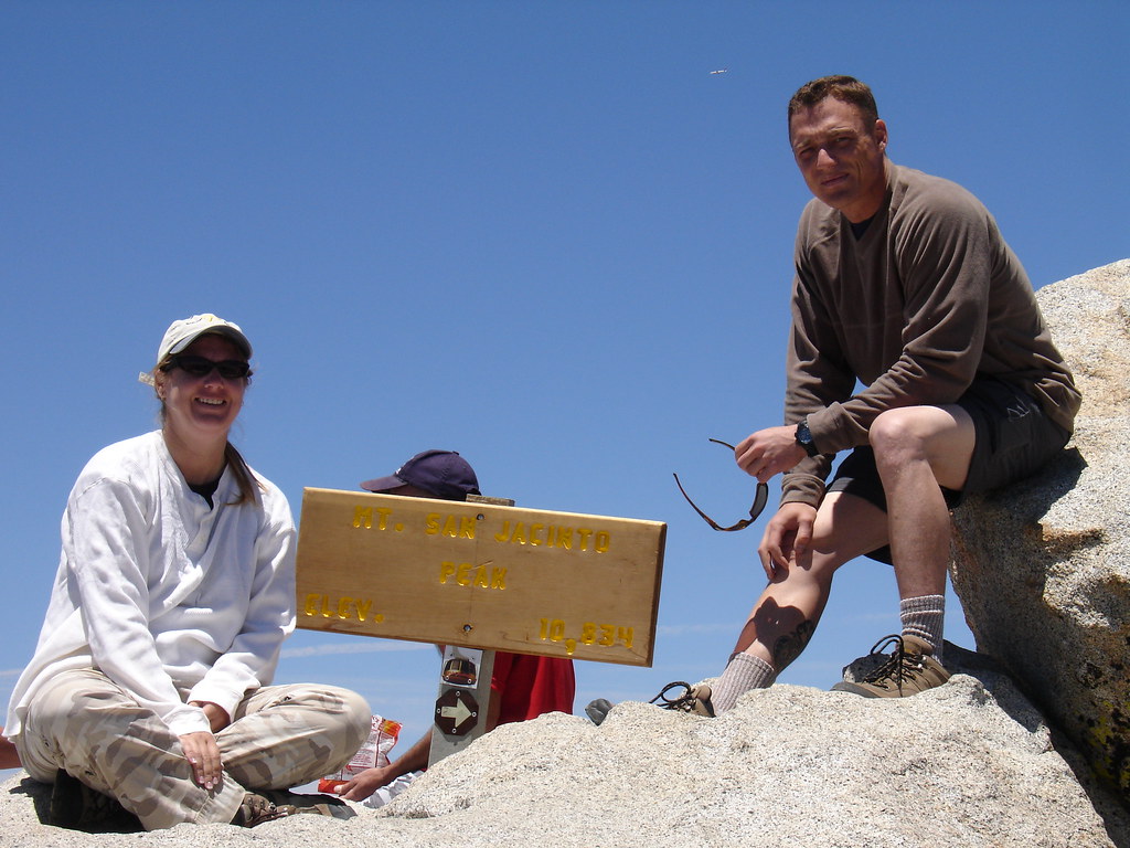
The snow became more frequent and we actually lost the trail for a while. It wasn't hard to figure out where to go. Up. After a few wrong choices we were soon climbing over the huge boulders that make up the summit of Mount San Jacinto. I could finally see the sign marking the feat and found other hikers taking in the views and taking off their boots.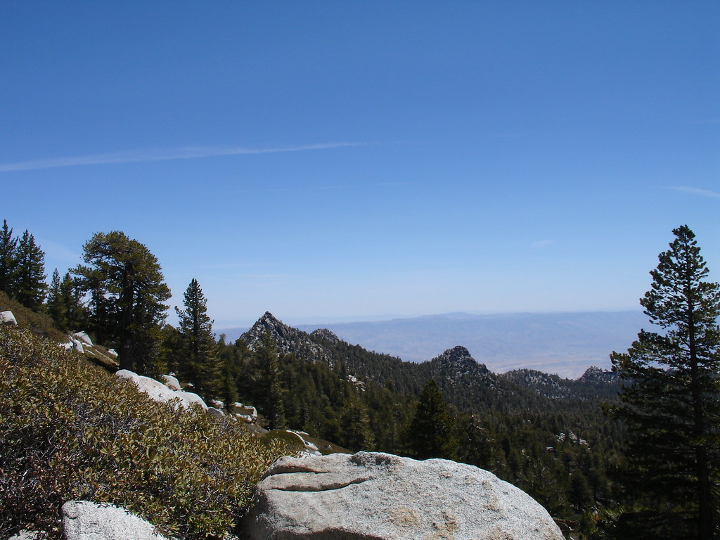
I had a whole bag of travel bugs that made the journey with us. I took a picture of each one on the sign at the summit. It took a long time to upload each picture to every bug's page and I hope the owners enjoy it.
Soon we were on our way back down. We found where we had missed a switch back and lost the trail. I soon realized that down is tough. My legs were tired. those steps down the trail and off of rocks hurt every time. We didn't take the time to search for any geocaches up there because we need our hotel room to save us.
The trail down seemed to take forever. It seemed so much more steep going down and we wondered how we ever made it up in the first place. The whole way back we kept talking about how great it was and about how badly our feet hurt. The mileage on the GPSr counts off very slowly when you are traveling along switch backs. We retraced our steps and finally made it back to the tram's Mountain Station.
The Tram ride down was full of people and I was imagining my feet soaking in the hot tub. We grabbed some take out and limped up to our hotel room. Second floor, go figure. We did a lot of sitting that night. When I zipped off my pant legs I forgot to put sunscreen on my legs and got a nice little sunburn on the backs of my legs.
We had done it. We made it to the top. The hike was no joke. 11 miles of steep rugged terrain. I was over packed and my knees were letting me know. The views were the best Southern California has to offer. We could see all of the other mountain ranges of SoCal as well as spectacular coastal and desert views. We hadn't even reached the tram and The Wife was planning our ascent to the highest peak in Southern California, San Gorgonio. I think the best investment I made for this trip was a pairs of Thorlos socks. They kept my feet dry and I'm sure I would have had some blisters without them.
The next day was going to reach 100 degrees in Palm Springs and our legs were not ready for the desert hikes and geocaching I had planned. We went for a walk near our hotel and picked up 6 finds along a nice bike path. That 4 mile walk was all we could handle and we surrendered to relaxing and activities that include sitting. While we were walking along a golf course back to our hotel we were watching two large coyotes looking for food in the wash. One of them was on the fairway for a bit. A woman was walking three small dogs in front of us and when one of them barked, the coyotes quickly approached. The woman was unaware of the danger her pooches were in. I got to where the coyote was stalking the dogs along the path and yelled at it. The coyote retreated and I warned the woman that her dogs were being watched.
This has been my favorite trip in the outdoors so far. While I did log the San Jacinto Summit virtual cache, the summit benchmark and an earthcache, the remaining traditional caches on the mountain will have to wait for another day.
I took way too many photos to post here so check out the rest at my Flickr page.
Tuesday, June 3, 2008
Mount San Jacinto Summit Trip
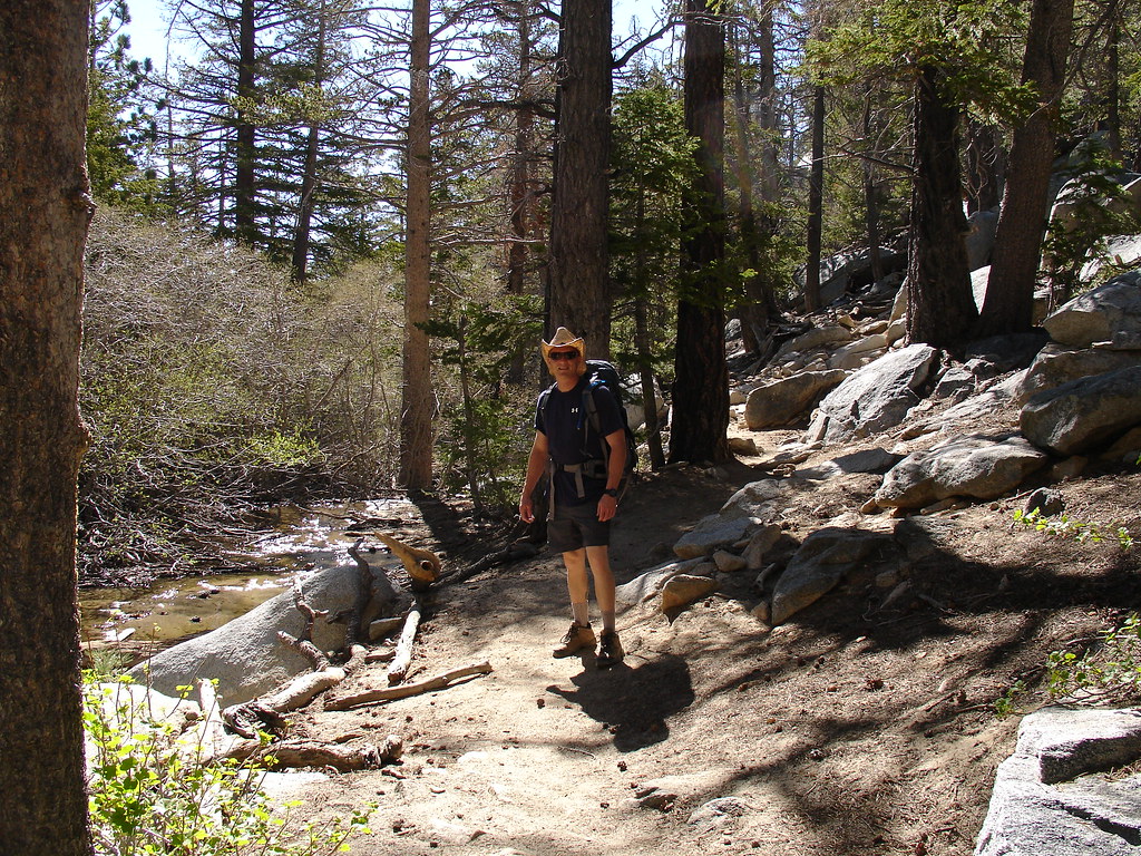
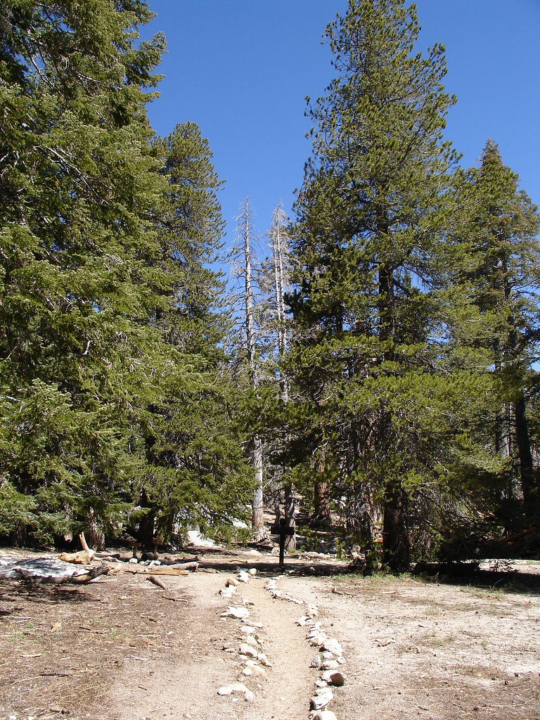
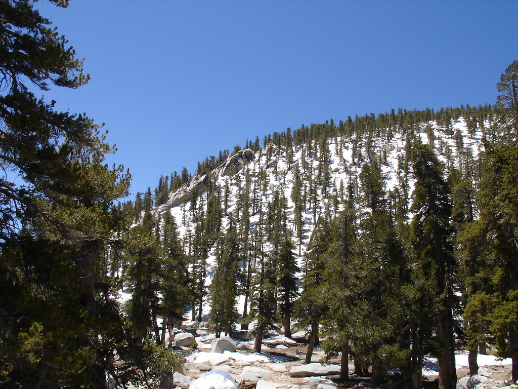

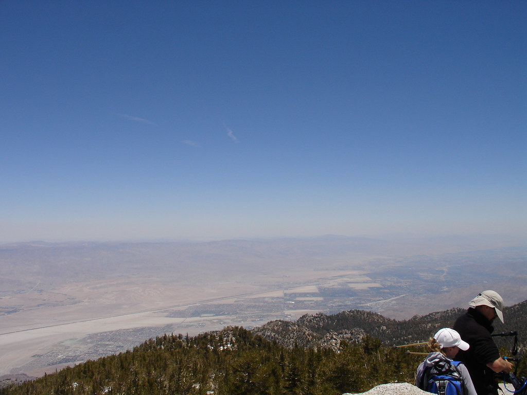

Saturday, May 17, 2008
A Fun Hike For A Geocache

We "hiked" right out our front door and headed out of the neighborhood. The local park has a nice dirt trail that made us feel like we were somewhat out of Suburbia. We crossed a busy Highway 79 and ended up on some old dirt roads.
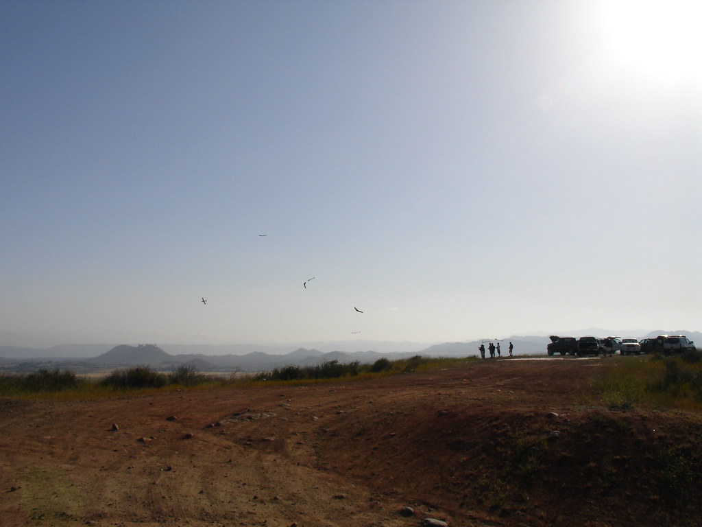
We were soon climbing an old washed out road leading to the top of a nearby hill. From the bottom we could see what appeared to be a swarm of birds flying in a group near the summit. It reminded me of sea birds swooping down on a school of anchovies that had been pushed to the ocean surface by game fish.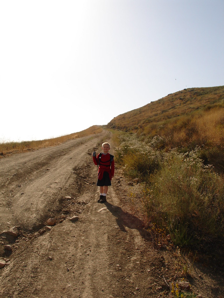
Ground zero soon belonged to us and I began searching the rock piles for our treasure. The Boy was watching a fire truck and ambulance scream along the road below when I made the find. It was a very cool tin container shaped like a pirate ship. Inside were many "gold coins" and a few other pirate themed trade items.
We drank some water and watched the gliders for a little while before heading back down the hill. On the way down we saw some people riding their horses in the open fields. We were soon back on our neighborhood streets and back at base camp.
We traveled just under 5 miles which is a long hike for only one Southern California geocache. I guess that's how they do it in Minnesota. The backpack proved very comfortable and I'm looking forward to putting many miles on it.


Saturday, May 3, 2008
Here Comes Some Fun Geocaching
 I haven't had much time to geocache in the past couple of weeks but there is some big time fun on the horizon.
First is the flash mob event on Coronado Island in San Diego. Next Saturday is WWFM III and we will be in one of the most beautiful areas in the world for our first flash mob. This event is being put on by the folks over at PodCacher. If you didn't get a chance to read my previous post about it, you can check it out here.
Second is a trip up Mount San Jacinto for a hike to the summit and some mountain top geocaching. There is an earth cache, a virtual cache and 6 active regular caches listed on the "top o the tram" bookmark list. Click the image of the mountain for a great photo gallery.
I am actually planning a hike up San Jacinto via the infamous Cactus to Clouds trail this October. This trail is considered one of the toughest hikes in California. You gain over 10,000 feet of elevation. That's actually more elevation gain than you get on a typical summit trip on Mt. Whitney. (Whitney is the highest peak in the lower 48 states.)
The wife and I are planning on taking the "easy" way up in June. We will ascend the first 8400 feet inside the comfort of the Palm Springs Ariel Tram. From there it's a 5.5 mile hike up the remaining 2000 feet to the summit. We plan to spend the day exploring our share of the 54 miles of available trails in this great state park. (Hopefully the fire danger does not close off our summit attempt) The temperature at the tram station is typically 30 degrees cooler than the desert floor. That means this summer we can cruise up the mountain and hike around all day, even camp in 70 degree weather. NICE! Come winter time we can ride up into the snow without having to drive in it.
Needless to say, there are some very exciting events coming up for us. I am very excited to get into my new hobby of hiking and climbing. I have to say that I have always wanted to climb a mountain. My family spent a lot of time out in nature while I was growing up. Geocaching has been the catalyst into pulling the trigger on some real hiking and camping adventures as an adult for me. I actually started a new blog that I will dedicate to these non geocaching adventures. I only have a couple posts on it so far but feel free to check it out here. These two hobbies will often go hand in hand and I will be sure to share those adventures here.
Saturday, April 19, 2008
A Geocaching Anniversary
 No it's not the anniversary of my geocaching career. It's my anniversary as Vice President of the Hick@Heart family. Yes, I was married on April 19, 1997. What other great events happened on this day, you ask? Let's see........
- 1775: The shot heard 'round the world was fired, starting the American revolution.
- 1897: The first Boston Marathon was run.
- 1956: Grace Kelly married the prince of Monaco.
- 2005: Pope Benedict was elected.
- 1995: Oklahoma City Bombing.
- 1993: Branch Dividian Compound in Waco, TX burns.
Enough with the history lesson. Today also happened to be date night at the gym. You get to drop the kids off for four hours and do adult stuff. The adult stuff we chose was to look for Tupperware, hidden in the woods, with small toys in them. Yes, we went geocaching for our anniversary.
Date night began at 5:00 PM. The kids had their bags packed ready for a night of excitement in the gym. They had pizza and a movie and got to play in the gymnasium. Dropping them off was kind of funny. There were lots of parents dropping kids off for their "four hours of sanity". the parents all had their nice "go out" clothes on. Some were even wearing ties. Only two parents that we know of had jeans, hooded sweatshirts and hiking boots on. That would be us.
 The kids were occupied and we headed down into Temecula. Into Wine country. I just had to stop at one cache because it contained a Minnesota Geocoin. If you haven't figured it out yet, Tonka_boy is my Dad and he lives in Minnesota. So this coin is practically family. Well maybe not, but it is a very cool coin and I just had to grab it.
We were traveling the back roads of wine country, through orange orchards and grape vines. The Geo-Prius was put to the test on some dirt roads for the first time. A resident stopped to see if we needed any help. He was very nice and told us about all the planned development in the area. It's sad to say that there will soon be many more houses along these beautifully empty roads.
 We headed into the Redhawk area of Temecula and into the Santa Margarita Riverbed. It's a dry riverbed and had some nice trails. While we were walking, we saw lots of large insects. There were some huge ants, even more huge stinkbugs, and some kind of centipede. I was surprised to see these centipedes pay no attention to the ants. I would have thought the ants would devour them. As the centipedes scurried along in the sand, their bodies left a trail and their many feet made very interesting marks along the sides. It looks like tiny tire tracks all over in the sand. That's twice this week that I've taken pictures of tracks in the sand.
We found another cache near a neighborhood park that used a very clever container. It was one of those travel soap dishes. The hider put an excellent camouflage paint job on it and it was quite difficult to spot inside the chaparral. The log book was bone dry and had never been wet. There was plenty of room for small trackables and trade items. It was the first time I had seen a soap dish used as a geocache container. Nicely done.
The Wife and I enjoyed our time alone walking deserted trails and driving the back roads. We found 8 geocaches and we picked up two geocoins and one travel bug. It also seems that nothing too disastrous happened in the news today. Here's to a good wife. One that enjoys a walk in the woods on our anniversary. I wouldn't have it any other way.


Sunday, February 3, 2008
Travel Bug Update
I just made a new travel bug and thought I would just post an update as to the travels of the others. This is Fish Tank TB21D2B. Fish Tank is still in my possession , I will be dropping him/her soon. This TB wants to travel the world and get its picture taken at, guess what, fish tanks. Nemo here also wants to see Lake Minnetonka in Minnesota. Hmmm, why do I know that place. I hear it's real nice. Nice and cold! That's kind of a side mission.
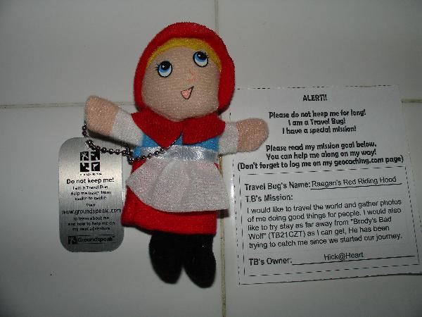
Brody's Bad Wolf TB21CZT just got dropped off in Duck Crossing, 40 miles from home. BBW's mission is to travel the world and gather photos of people being bad. He also is trying to catch Raegan's Red Riding Hood. Check out the trail of caches this TB is in! Thi
Thi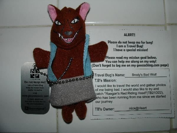
Raegan's Red Riding Hood TB21D22 is running from BBW and trying to gather photos of people doing good things. This TB is only 16 miles from home in Bautista Hike, and has only moved once.
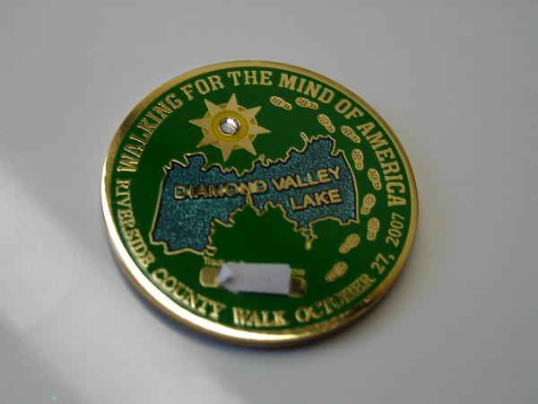
My Motogrrl Geocoin is still at Penny Pines Plantation where I dropped it. No one has logged the cache since I was there on December 31. I am holding onto my FTF Prize Geocoin that I just got. I am virtually dropping it in all the caches I find and logging mileage on the coin. As of today, it has 82.4 miles. I love trackables! I still have one set of unactivated TB tags. I'm just waiting for a cool hitchhike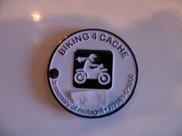
Sunday, January 13, 2008
We Found a Geocoin (From 12/24/07)
We got to go do some Geocaching on Christmas eve. The temperature was in the 70's today, perfect for December. We once again started the day with a DNF. We were searching for a micro in a nearby park. Julie and I looked all over while the kids played. There was some Asain lady at one the tables who must have thought we were crazy. We moved on to some normal sized caches.
We found this one pretty easily. It was one of those M&M mini container tubes. They had it taped with green tape and fake leaves stuck to it. Nice hide. that was fun!
Then we headed over to this cache. This cache was along the fence of the Anheuser Bush Clydesdale stables. What beautiful animals. This was an ammo container with lots of goodies inside. Brody grabbed a stress ball that looks like the earth, and Raegan grabbed a plastic Poo character. There was also an unactivated Geocoin inside! We grabbed that and activated it. You can look it up using the TB (TB15VCF) I'll be dropping it off soon and we can watch it move!
This one was just up the road along the same horse farm. Another cool hide in some large rocks.
The last one we grabbed today was here. It was a full size Ammo can with lots of cool stuff in it. Brody grabbed a toy and it was time to head home.
I ordered a couple of travel bug dog tags today and will be setting them free soon. I also got some stickers to put on our first cache that we will be hiding this week. I'll post the numbers when I get them.
We are also planning a caching adventure into the Cleveland national forest very soon. Hmmmmmm I'll be needing some cool places to drop my new trackables.
I have some great pictures that I'll be posting soon. I'm having trouble uploading them right now.
Have an Idea? Open your free online storefont here.


